This is part 4 of a series. Part 1: Into The Himalaya, Part 2: Pilgrimage To Everest, Part 3: High Himalaya
Day 11: Chukkung to Dzongla
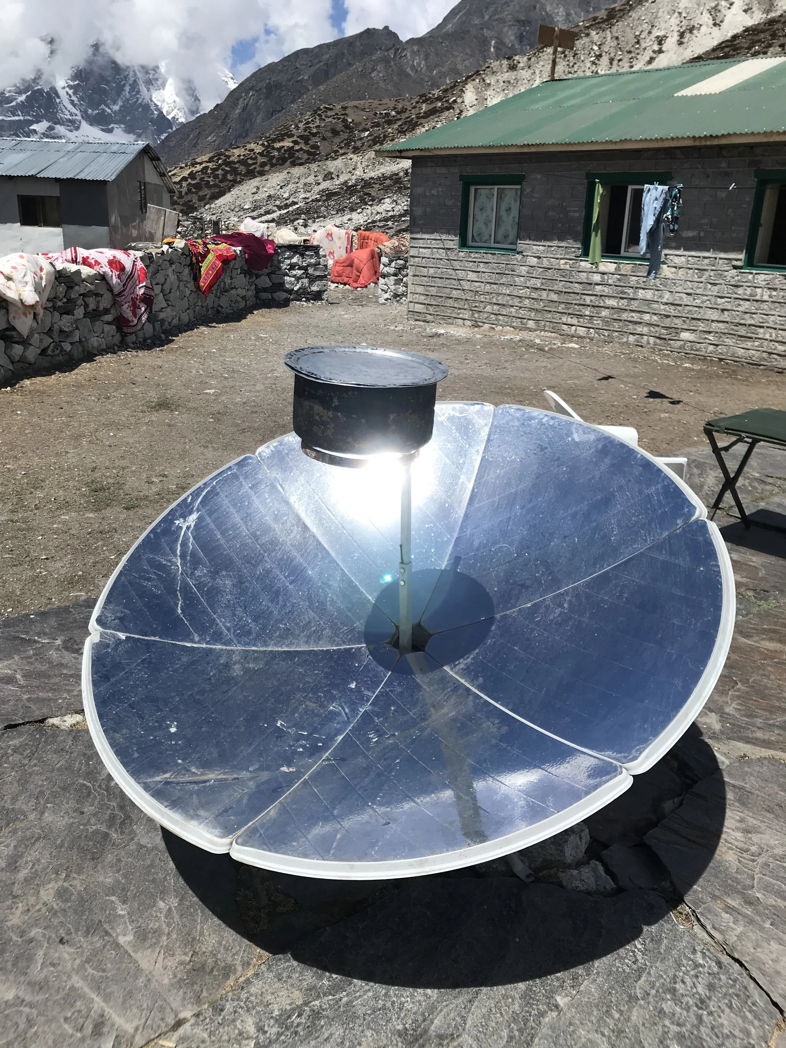
Now on the second half of our expedition, we began the day by bidding farewell to the amphitheater of stunning peaks and snowy ridges that surround Chukkung. The trail led us back towards Dingboche, covering the same stretch we had traversed 48 hours earlier. With the morning sun streaming from our backs, a few points of bright light shimmered in town. The cause of these was large circular solar dishes which funneled the heat into a single point like a magnifying glass, thus bringing large pots of water to a boil.
In Dingboche we turned back onto the Everest Base Camp trail, but our timing ensured we had the wide sloping valley to ourselves. Here the landscape eschewed almost all signs of life, making us feel like astronauts exploring the surface of the moon.
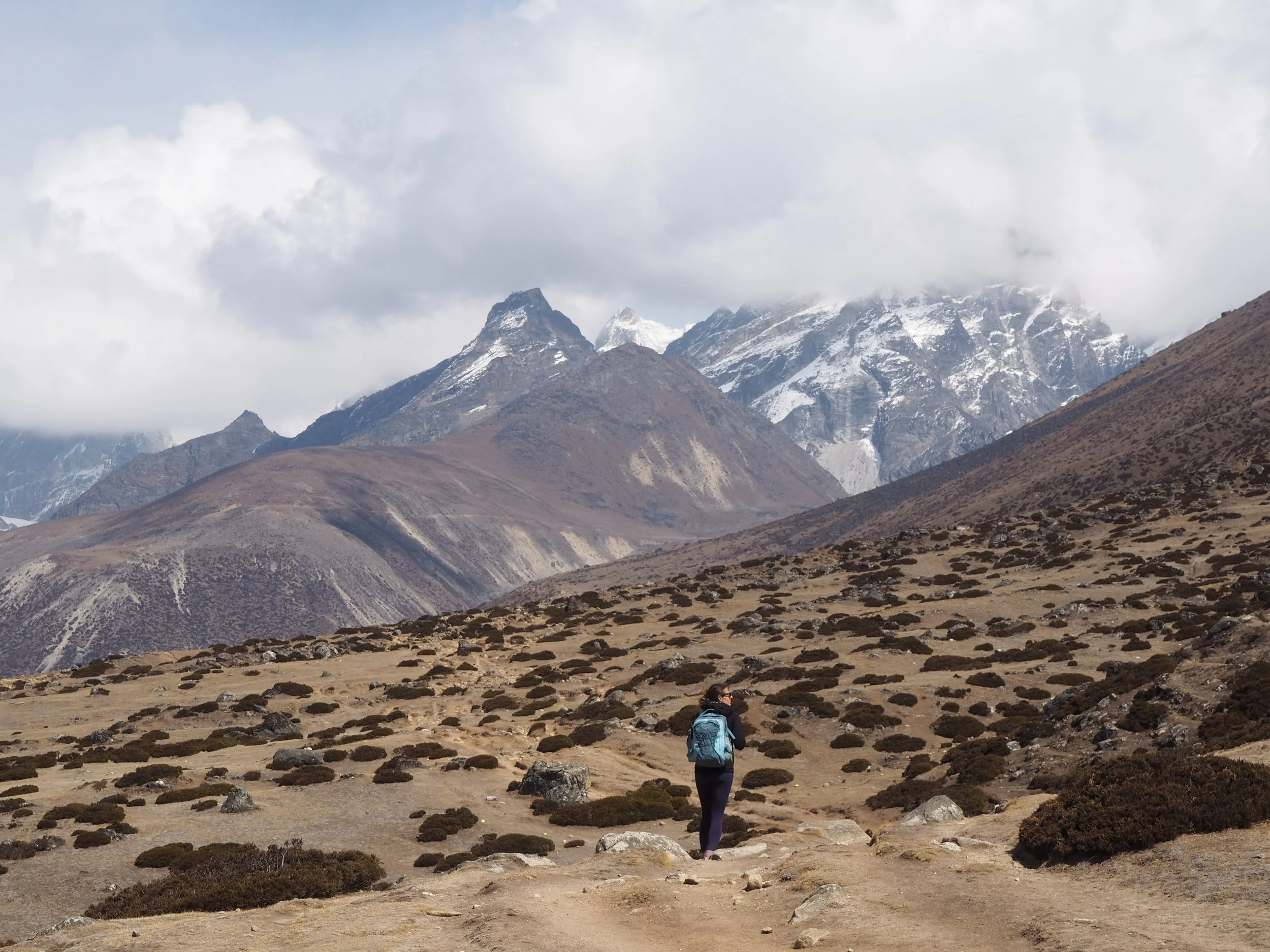
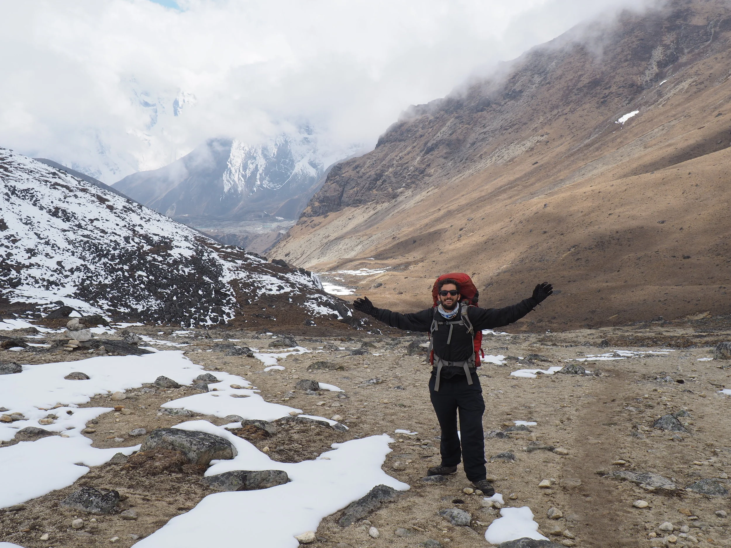
A strong tailwind pushed us further away from the valley that had held our attention for almost a week. I turned to get one last glimpse of Ama Dablam and was greeted with a full blast of icy wind to propel me along. The newest mountains were now on our left-hand side, separated by a wide valley that held a long river and a small village in its embrace.
The topmost peaks were hidden by clouds, but that did little to detract from our growing sense of wonder. Monstrous scraggly rock cliffs held frozen waterfalls and hanging glaciers, while in the distance we could see a large black tongue of ice breaching the valley floor.
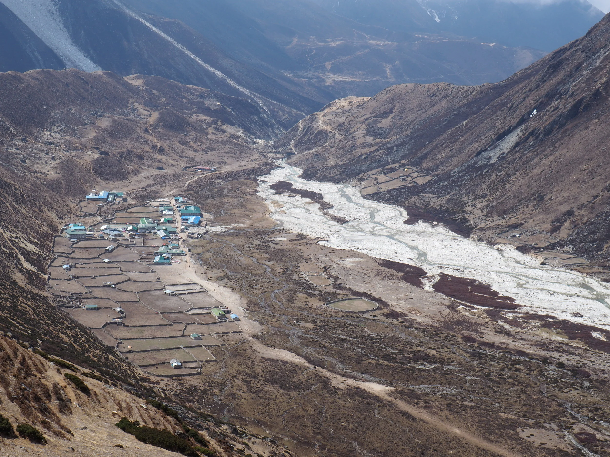
Eventually the path narrowed to a muddy cliffside trail. Whereas previously I had been done in by false summits, now I was flummoxed by a never-ending set of turns. Each curve might have been the last one, but it was another hour until I glimpsed the town of Thukla. Here a monstrous stretch of white boulders amongst a thin stream spoke to a river that must have once dominated the geology of the region.
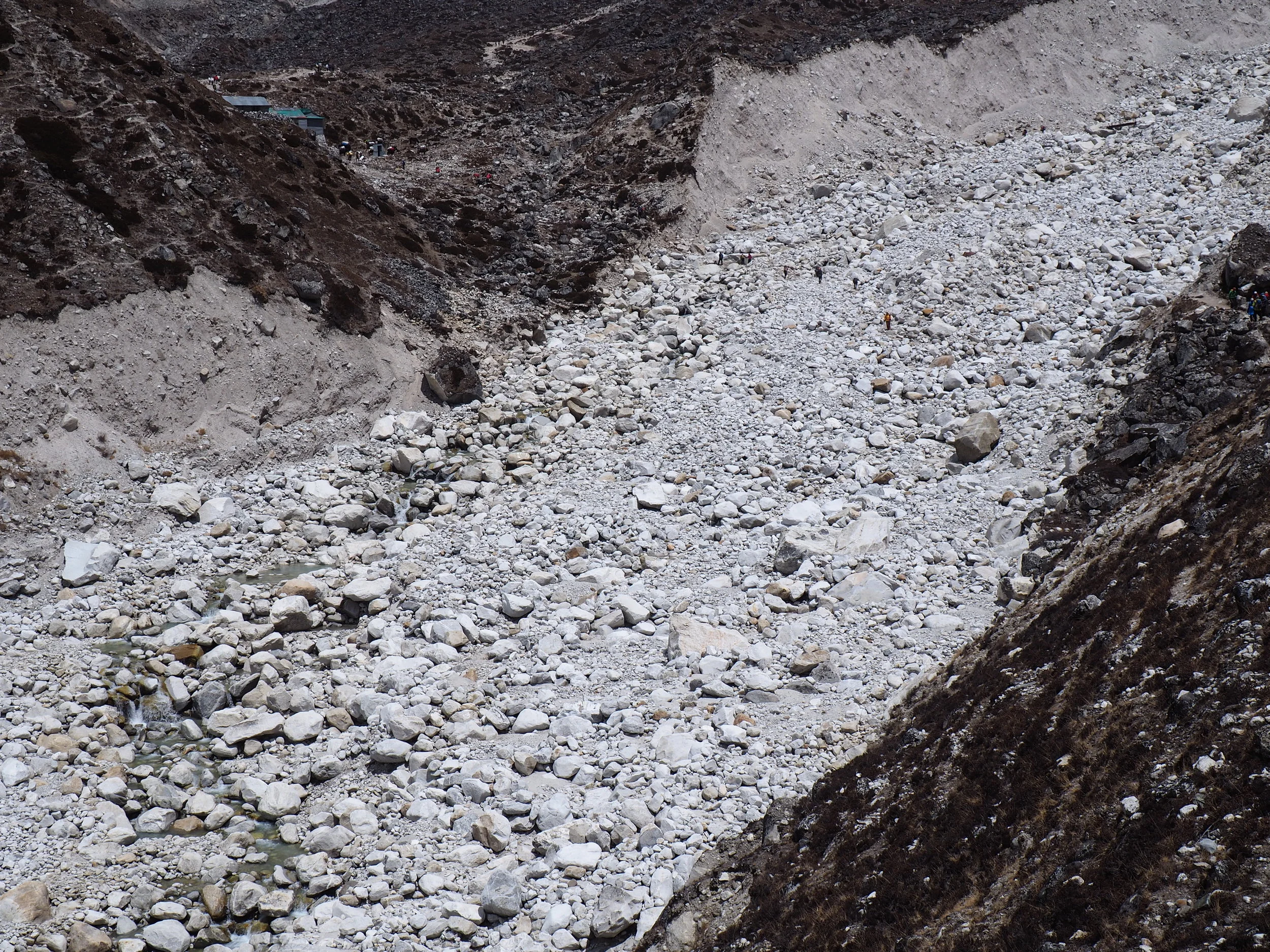
Beyond the ancient river bed was the town, which seemed to be nothing more than a lunch spot for hikers headed for Everest Base Camp. The two restaurants in town were clustered with big packs of Chinese and American tour groups, which felt like a drastic about face from the blissed out independent trekker hub of Chukkung. Coinciding with the groups were exorbitantly high prices, so we munched on granola bars with peanut butter and were soon off again.
I was immensely grateful that we only had to follow this main trail for another 10 minutes. Very soon we turned off towards the town of Dzongla and the trekkers headed for base camp resembled a huge traffic jam of ants on the side of the mountain. In sharp contrast, we saw only four other souls the rest of the afternoon.
The trail in this section was much more difficult. Switchbacks zig-zagged up a steep uphill, then we leveled off onto another broad plain with an almost imperceptible uphill which slowly decimated our calves. The wind was back, but this time it roared in our faces instead of acting like a sail at our backs.
Just like the previous section of trail, we were also accompanied by big black mountains which seemed to loom larger than life and a stupendous glacier which spilled across our view.
As we approached the town of Dzongla, the trail narrowed into a muddy cliffside rut that was barely fit for a goat. With a steep tumble just one false step away, we kept our eyes firmly fixed on the ground in front of us as the day’s first snowflakes came fluttering down.
The afternoon precipitation was right on time, so I paid it no mind because we had gotten two brief dustings of flurries in Chukkung. Yet just a few minutes later we were swallowed by a violent blizzard. The tiny snow pellets whipped across my face as we managed the last two uphills and downhills into Dzongla, which seemed to get farther away everytime I looked up.
With my last gasps of energy I pushed up the final hillside to the snow-covered town which would be our home for the night and sits at an elevation of 4,800 meters (15,700 feet), higher than every mountain in the continental United States.
Day 12: Dzongla to Dragnag via The Cho La Pass
The snowstorm that accompanied our arrival in Dzongla failed to stop all night; by the time we awoke the next morning four inches of fresh powder encompassed our surroundings. The snow turned our the environment into a land of heavenly white; even peering back into the valley we had crossed yesterday was a majestic sight.
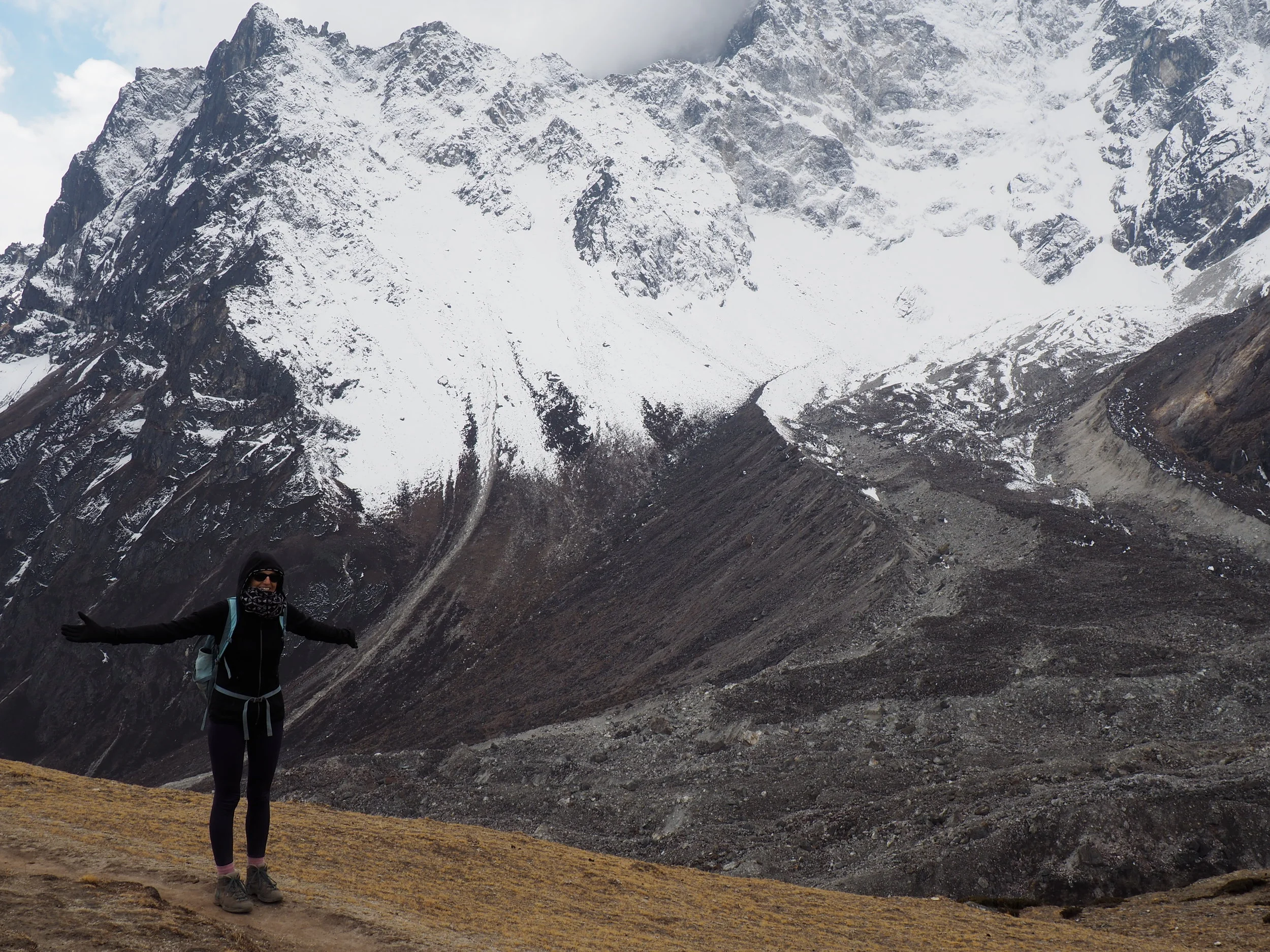
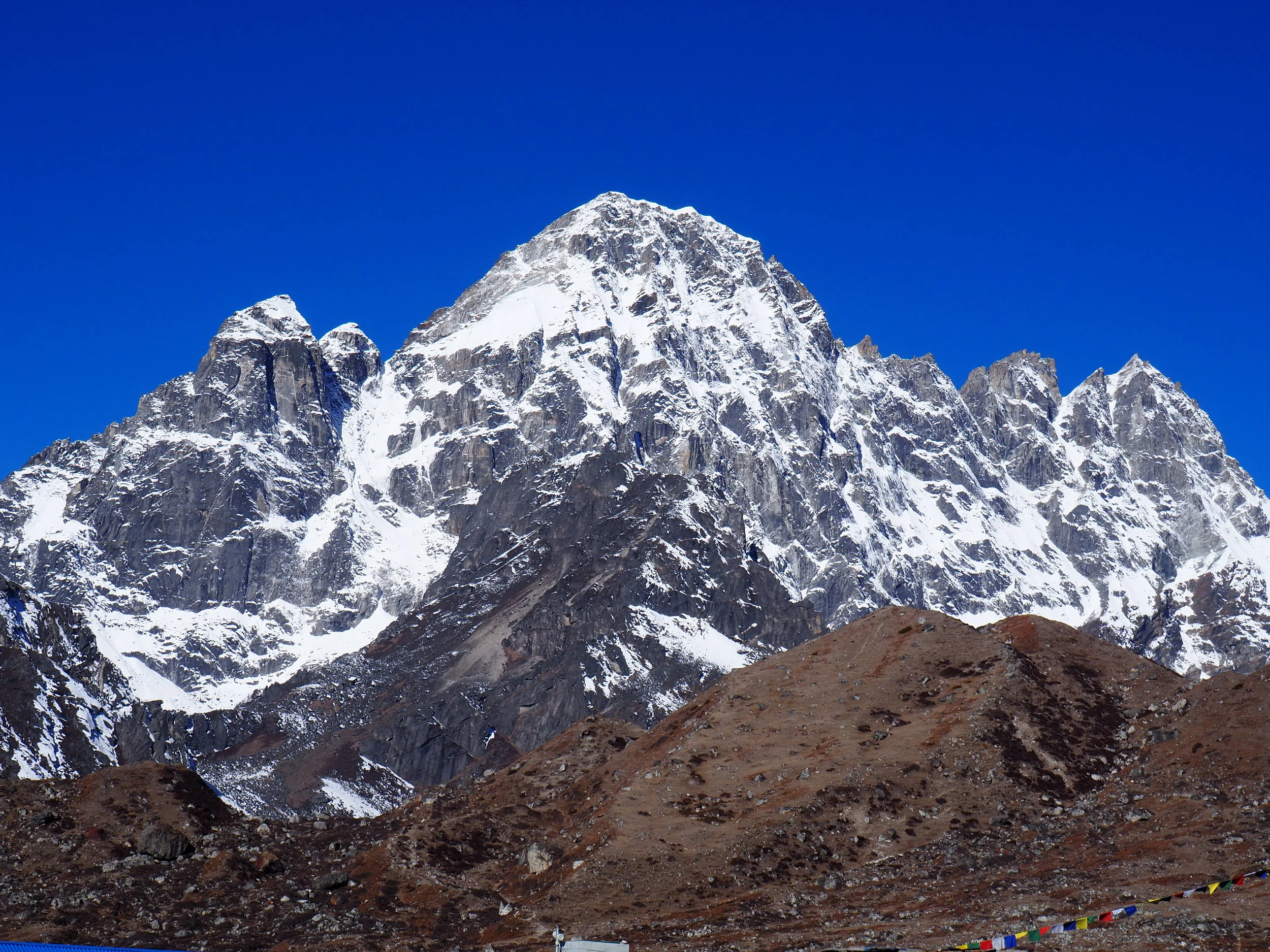
Yet now we had to turn around and come face to face with the Cho La pass, our fiercest obstacle yet, in less than ideal conditions. Despite the challenge, the trail instantly yielded stunning views. Cholatse was absolutely glowing in the morning light, its snowy crevices glistening and its peak pointing straight to heaven.
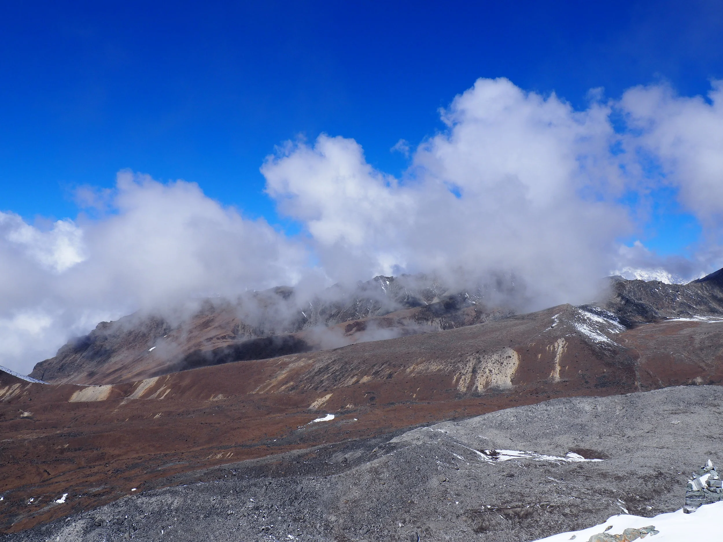
Even within the first hour, the trail was obscenely difficult. Through ankle deep snow, we wound our way up above 5000 meters (16,400) surrounded by glowing heaps of sparkling white. In front of us, the path was downright disconcerting: we were headed straight towards a seemingly impassable chain of mountains.
Some were deep black, others light grey, but each section of the ridge held its own beauty in the glow of first light. My favorite was a triangular spire which had the intense shape of an arrowhead, its deep black hue pointing sharply towards the blue skies.
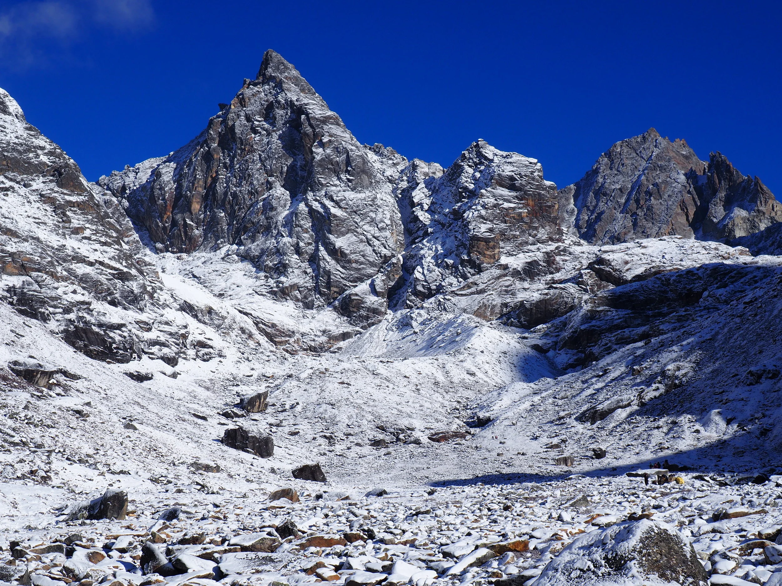
The panorama continued from left to right, running alongside a steep line of peaks until culminating in the shady presence of the Everest range. Due to the altitude and the constant sinking of our feet into snow and sludge, we barely had the presence of mind to enjoy these surroundings. The trail wound through pockets of shadow and sunlight, then quite suddenly got insanely steep. Soon we were climbing over boulders covered in slush up a treacherous incline while melting snow dripped on our hands from an overhanging rock wall.
The climbing here was the toughest yet; we lunged up tall rocks and squirmed through tight crevices while trying not to fall off the intensely slippery way.
Towards the top of this section I had to rest every few steps, but the reward of the view from the snow-covered plateau was well worth the struggle.
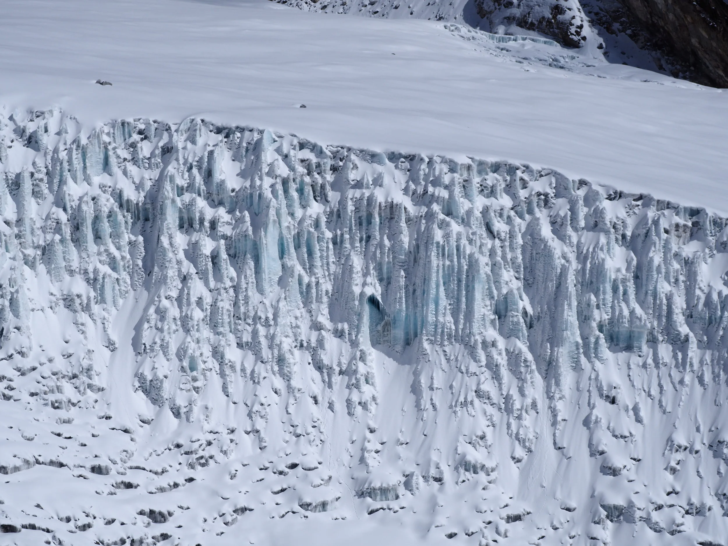
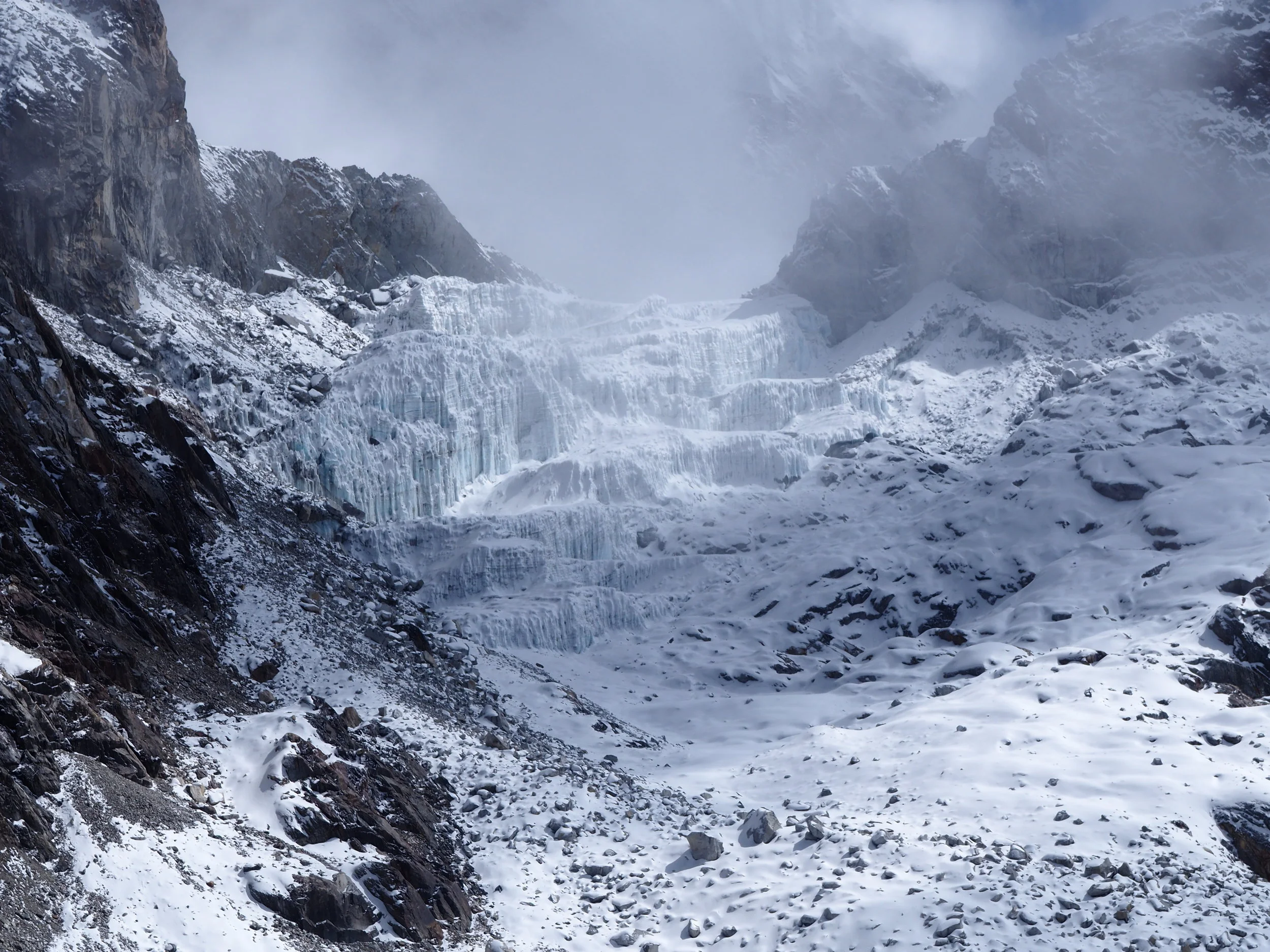
After a few minutes of taking in the sun-drenched snowy hillsides and catching our breath, we strapped on our crampons to cross a dangerous stretch. Here the fresh powder was almost a foot deep and the trail just a single boot width across, with the possibility of falling into a deep crevasse constantly on our minds. To our right a glacier began to swallow our view, with a front face of icy pillars that stretched 25 feet from top to bottom.
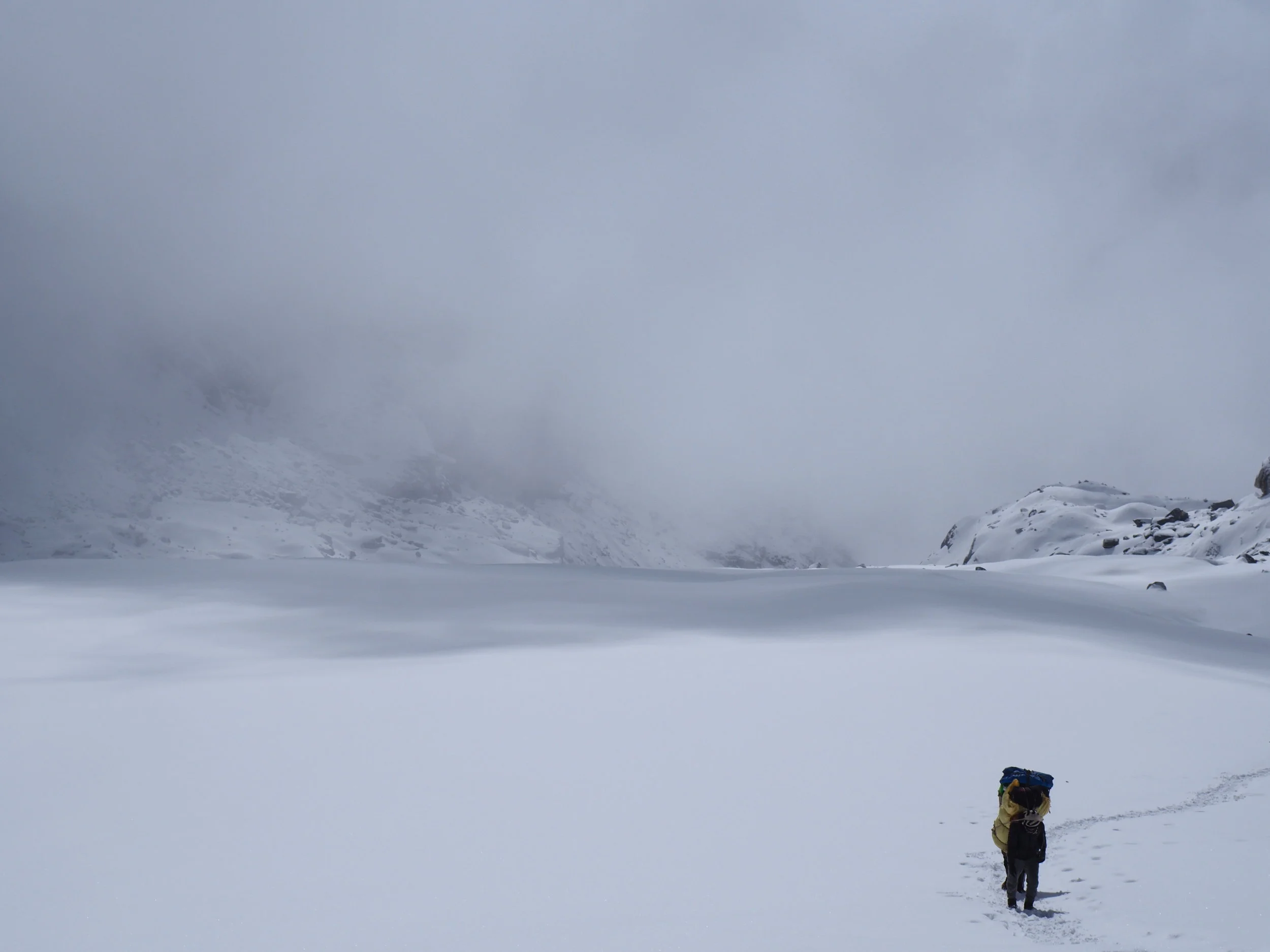
Within a few minutes we were walking across the pure white upper portion of this glacier, but now incoming cloud cover added an additional foe to be weary of. Eager to reach the topmost section of the pass and glimpse the choicest views across the other side before the clouds swallowed our entire universe, I pushed on ahead at a pace that was much too fast.
Behind me, the glacier was quickly dissolving into a single layer of milky white, punctuated only by a few humans braving the elements.
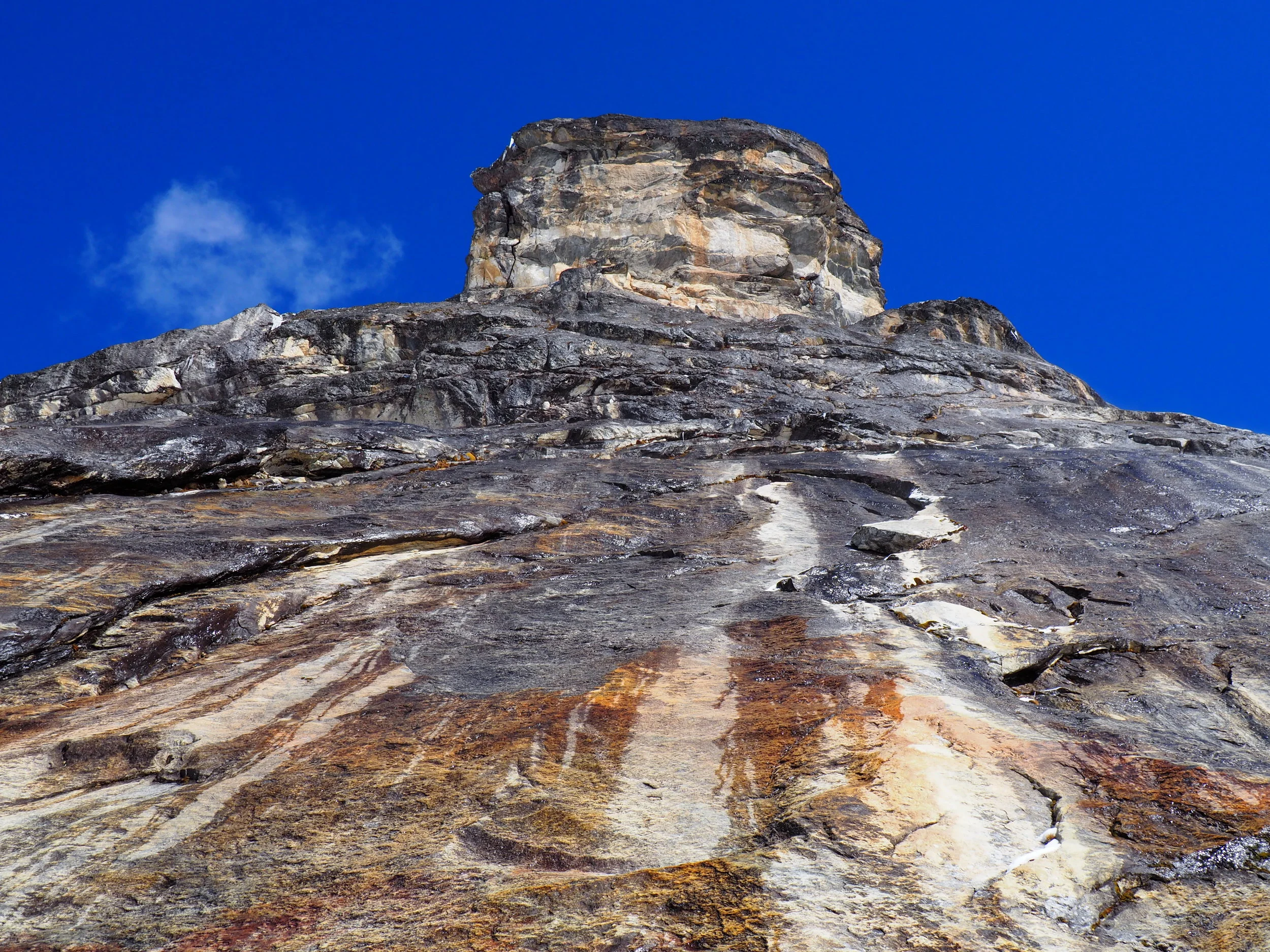
In front, a high wall of ice rose and sparkled in the remaining sunlight, so smooth in parts that it seemed ironed by the hands of some higher power.
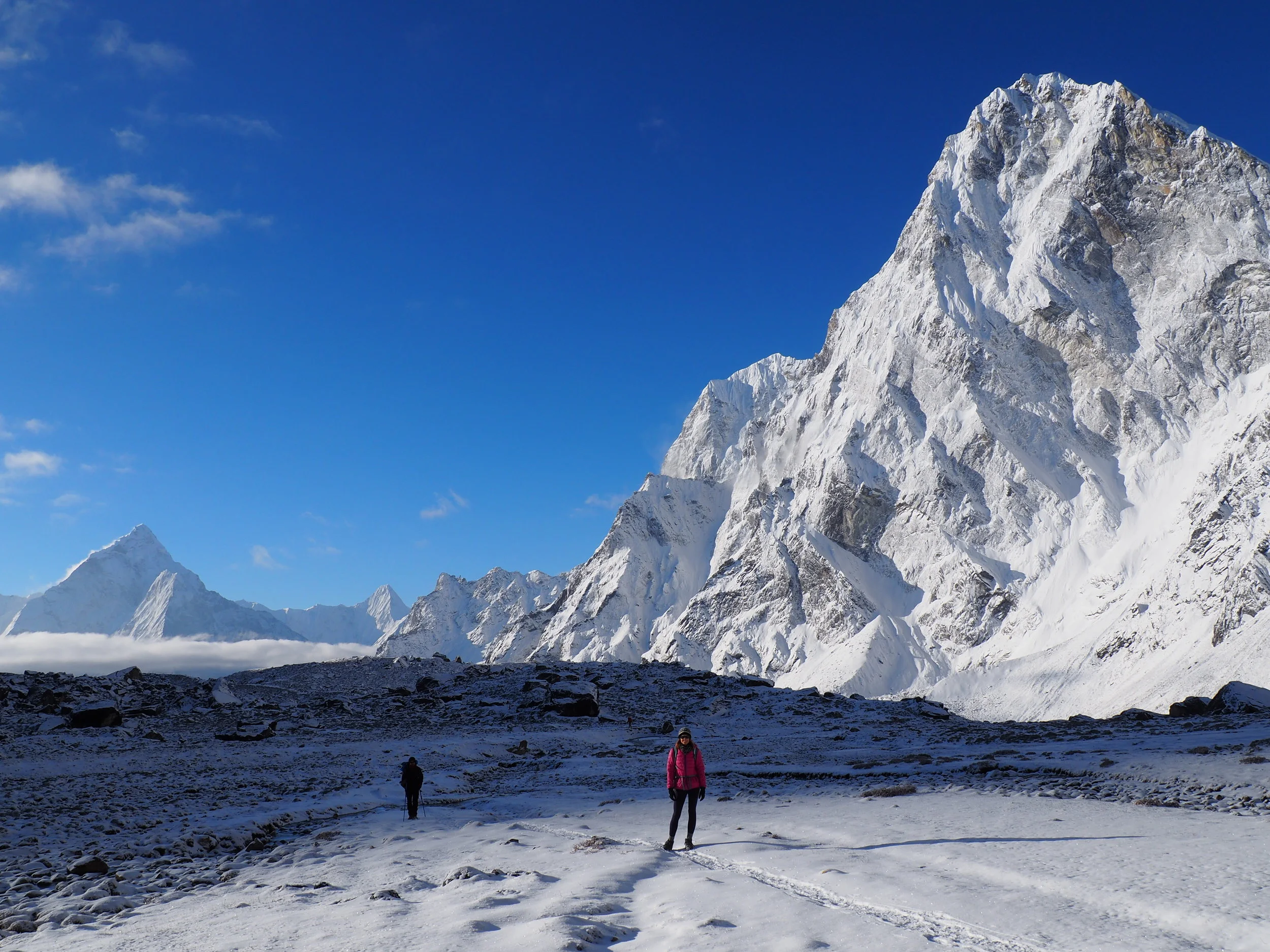
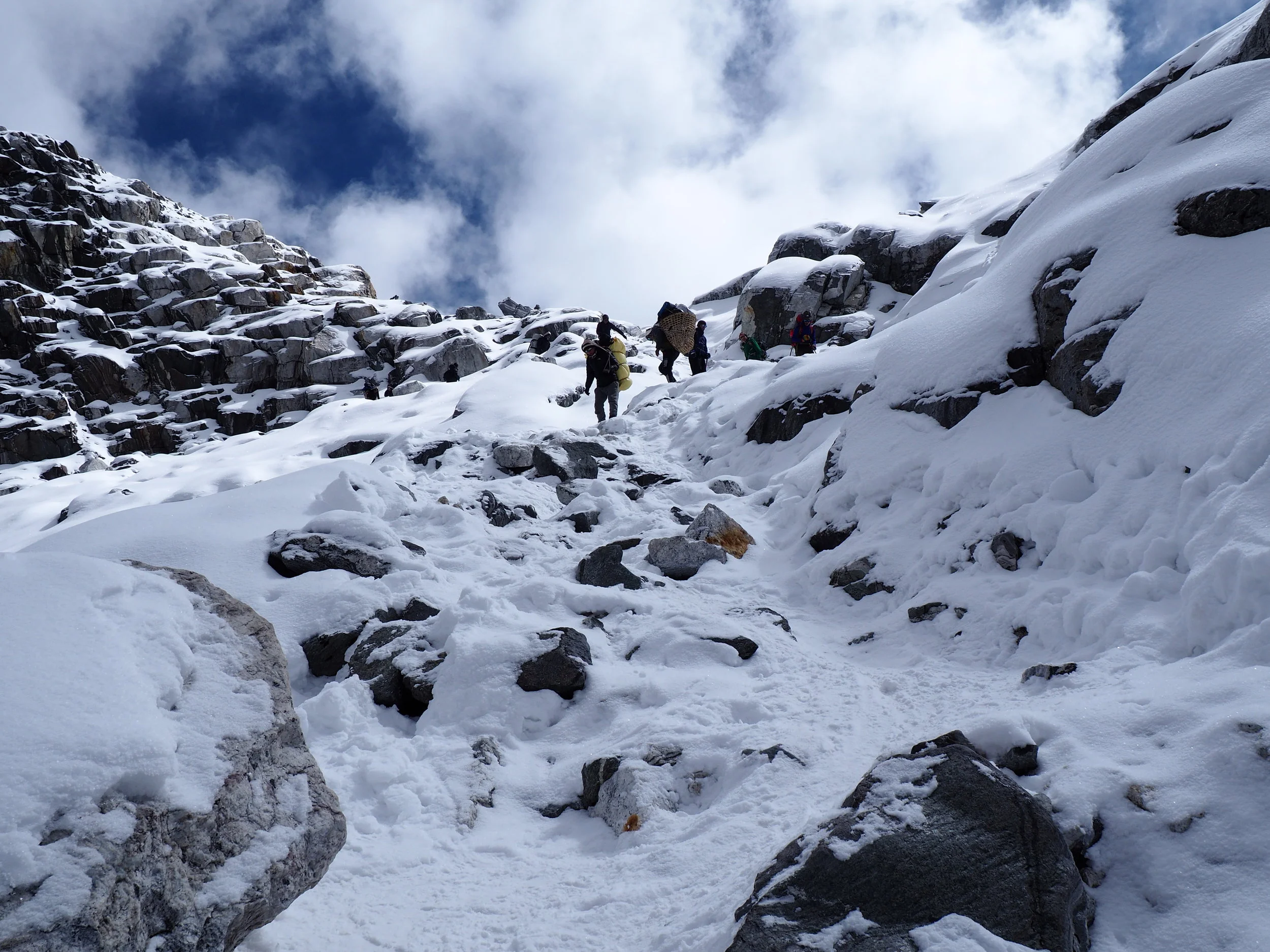
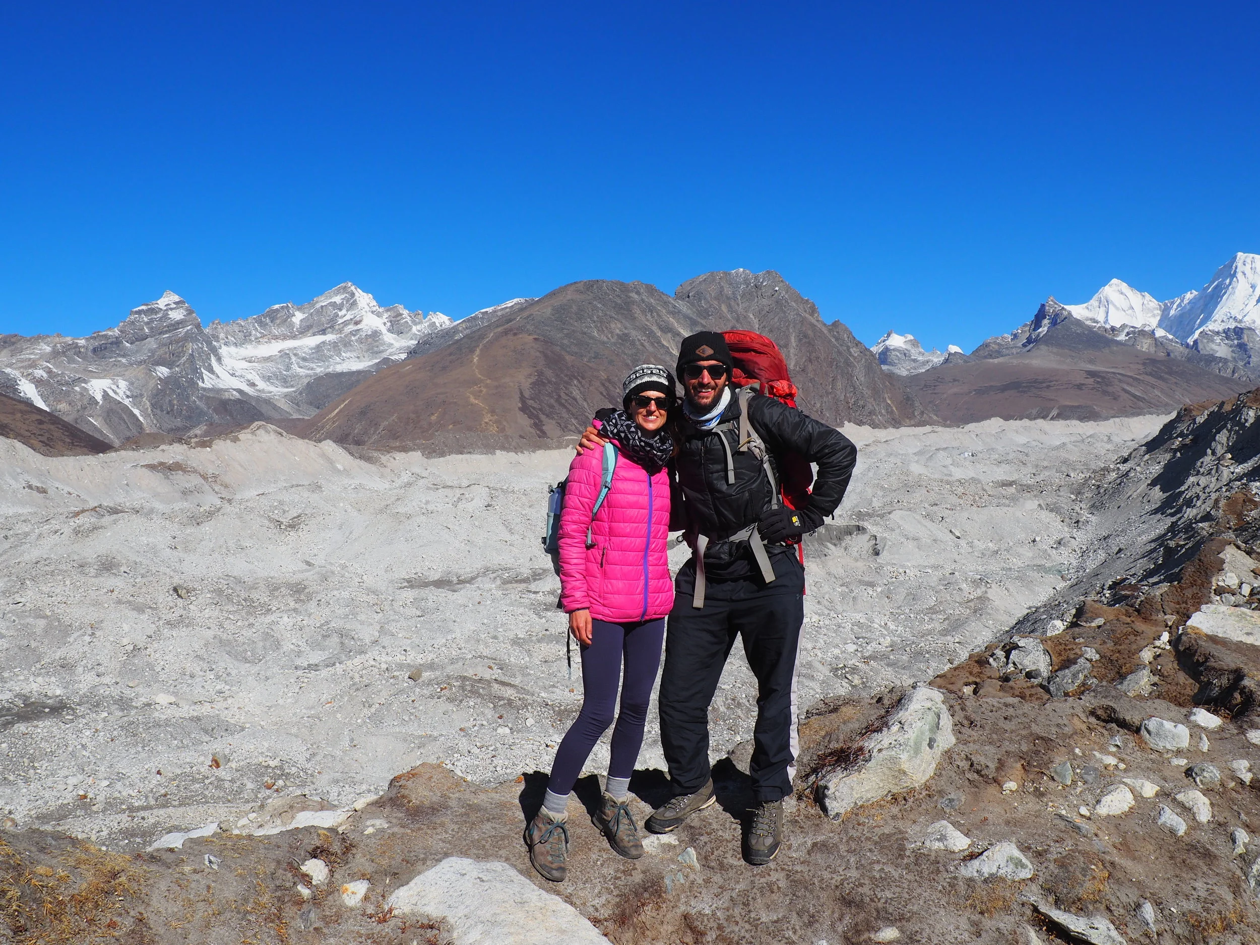
With one last surge up a vertical wall of boulders and rocks, we made it to the top of Cho La pass at an altitude of 5,420 meters (17,800 feet). Hikers from both the Eastern and Western flanks were rejoicing in having reached the culmination of the day’s hike, completely unaware of the harrowing descents in front of them.
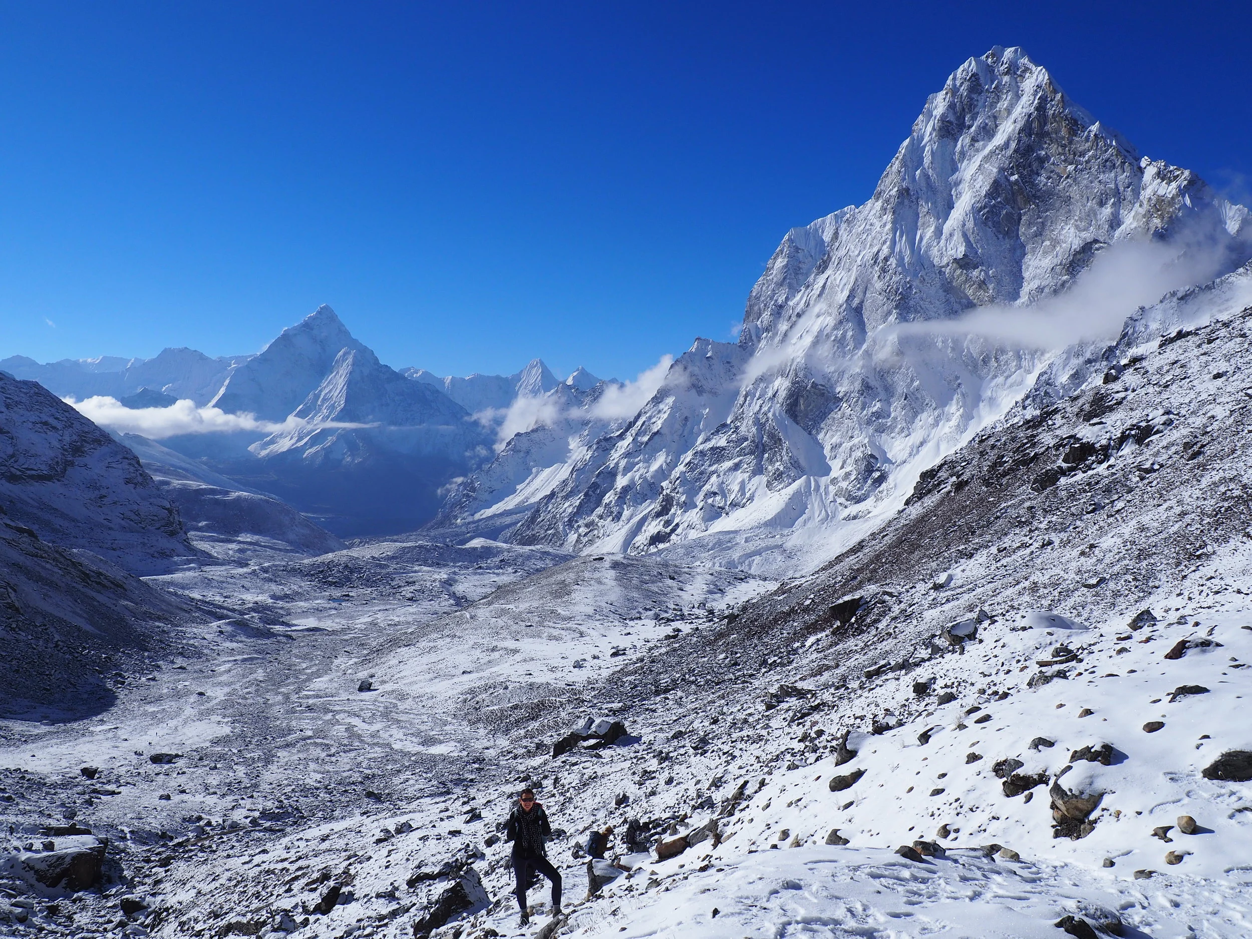
Group photos were snapped, pack lunches were rapidly consumed, and congratulations were exchanged in a wide variety of languages. In front of us, we could now glimpse a sampling of what the afternoon had in store. Whereas the morning trek was a mirage of sheer brilliance and white, the afternoon's valley looked barren and dead. Big black boulders littered the way and low yellowing grasses were the only signs of life while in the distance grey clouds shrouded the most noteworthy peaks.
But we could also see quite a few gorgeous glaciers. They sloped down from the highest mountains in layers like the pipes of a cathedral’s organ.
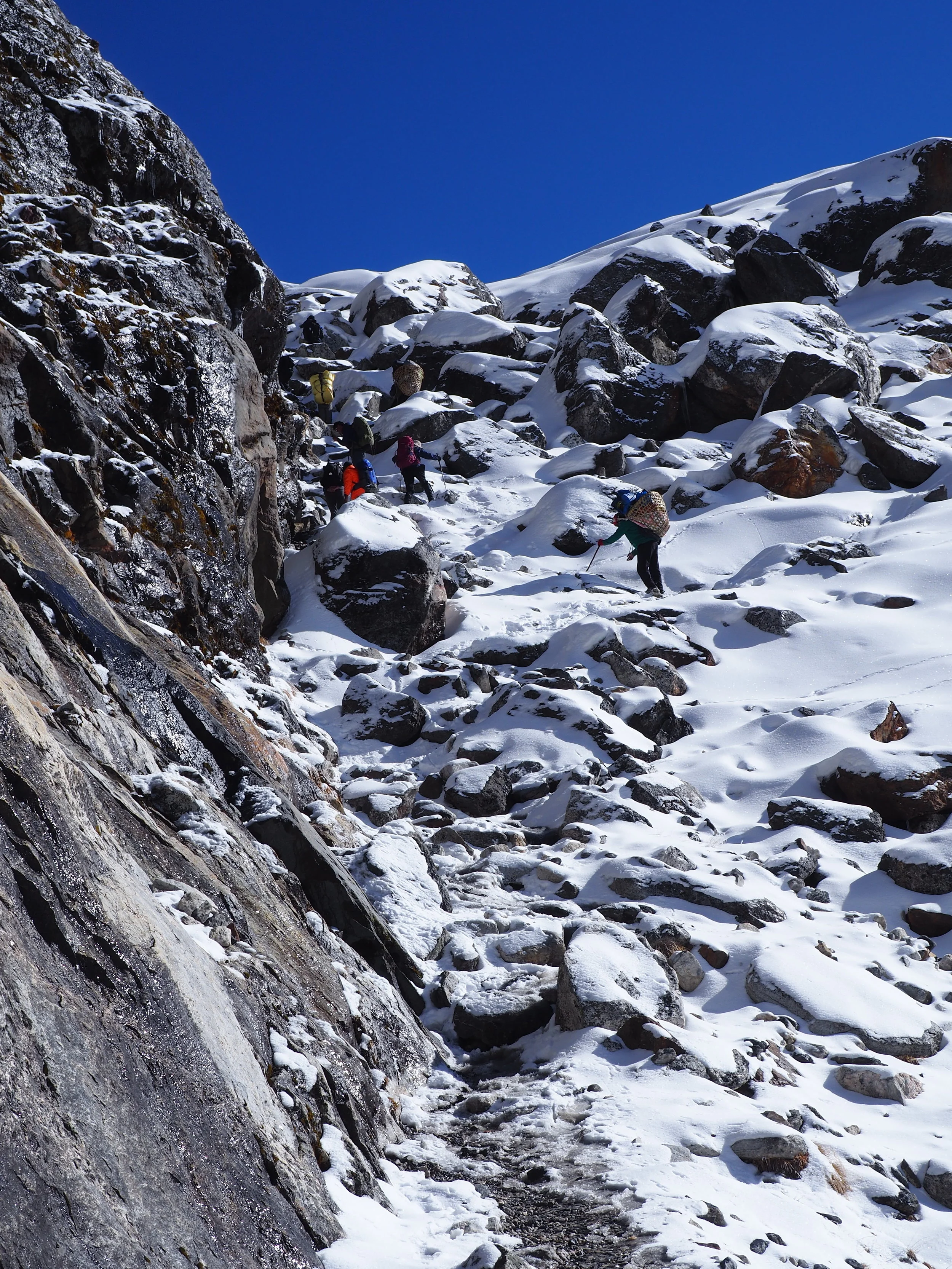
Before our legs could get too cold, we set off down the other side. Unfortunately, this was even steeper and more difficult than our morning climb. While we were lucky enough to have one crampon on each foot, those without were faced with no choice but to slide on their butts while rocks jutted out dangerously from the trail. There was simply no footing here!
Every additional step was treacherous, leading to more than a few yelps and falls from above or below us on the trail. Luckily we escaped without major damage, then turned back and shook our heads in amazement at the angle of the snowy slope we had just descended.
Just as soon as the trail leveled out, we found ourselves navigating a boulder valley with absolutely no path to follow. Over snowy rocks we tried to find a few bootprints that might lead the way, but ended up giving up and just walking in the right general direction. Now lower in the valley, the calm of the morning was gone and strong gusts of icy air came whipping down from the mountains.
We were finished with two of the afternoon’s toughest tests, but it was still a long way to salvation in Dragnag. With weary legs and huffing lungs we crossed one steep ridge, then another, leading into a gully that would finally lead us back towards relative civilization.
Out here on the open plains, the silence was absolute. Even the river seemed to abide, as it was completely frozen in the steepest sections.
I took in wide circles of the most inhospitable terrain yet, with the impenetrable Cho La pass lurking like a monster in the distance behind us. As we descended, signs of life slowly began to return. First it was the water, sweeping under an icy top layer and then gurgling along our left side in a small stream. Second was the wildlife, as we were lucky enough to spot a herd of Himalayan goats grazing serenely on a steep hillside. Third and finally, the green corrugated tin roofs of Dragnag came into view and relief washed across our faces.
I never thought I could be so happy to see simple sights such as people doing laundry, yaks grazing on grass, and women planting a new crop of potatoes.
Just a few minutes later we were peeling off sweaty socks and happily collapsing in the warm embrace of the guesthouse, immensely pleased to be finished with the most difficult day of hiking thus far.
Day 13: Dragnag to Gokyo
When I awoke on Tuesday morning it seemed like the worst weather of the trip. However, once the sun rose the veil of clouds lifted and it was suddenly one of the most beautiful clear days we had seen in Nepal. Luckily it coincided with the shortest walking itinerary of our journey, giving us plenty of time to take in the Gokyo mountains that were obscured the day before.
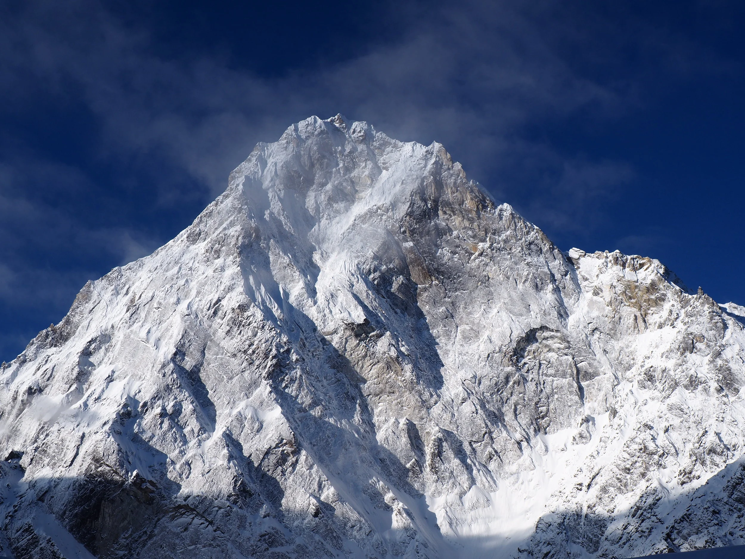
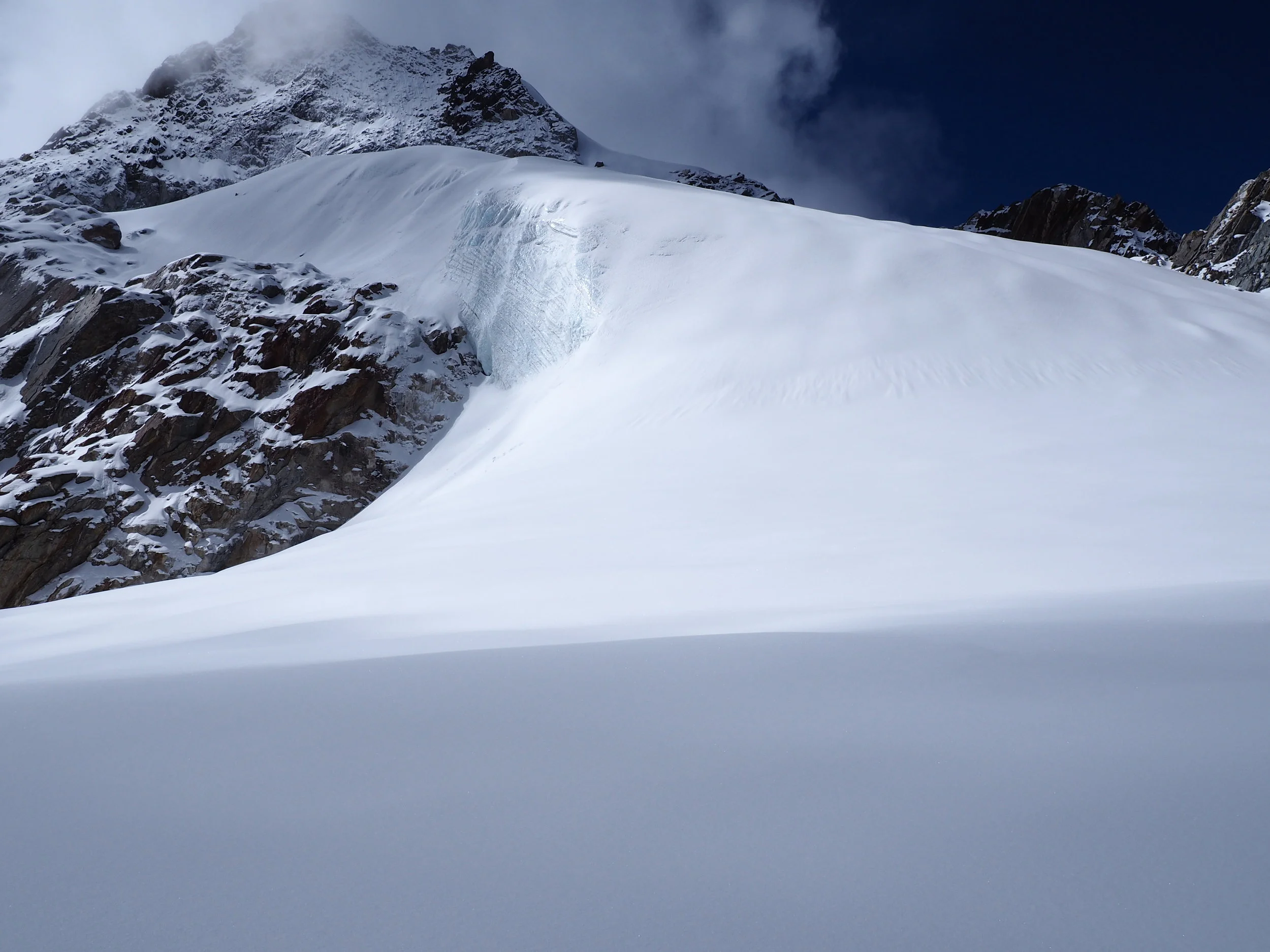
The path started off walking beneath a high ridge which hid our desired sunlight, diving us back into cold shadows and causing frost to rise from our mouths with each breath. Within just half an hour we had reached a steep ledge overlooking a long grey glacier, a vast unbroken chain of gravel and ice which stretched all the way back to Cho Oyu’s mountain range in the distance.
Cho Oyu, the world’s sixth highest peak, reflected the sharp light perfectly in the morning, with glimmering whites and sparkling silvers glaring straight into our eyes. Between the highest peaks we could glimpse thick layers of glaciated ice which dropped down in levels towards the broad valley.
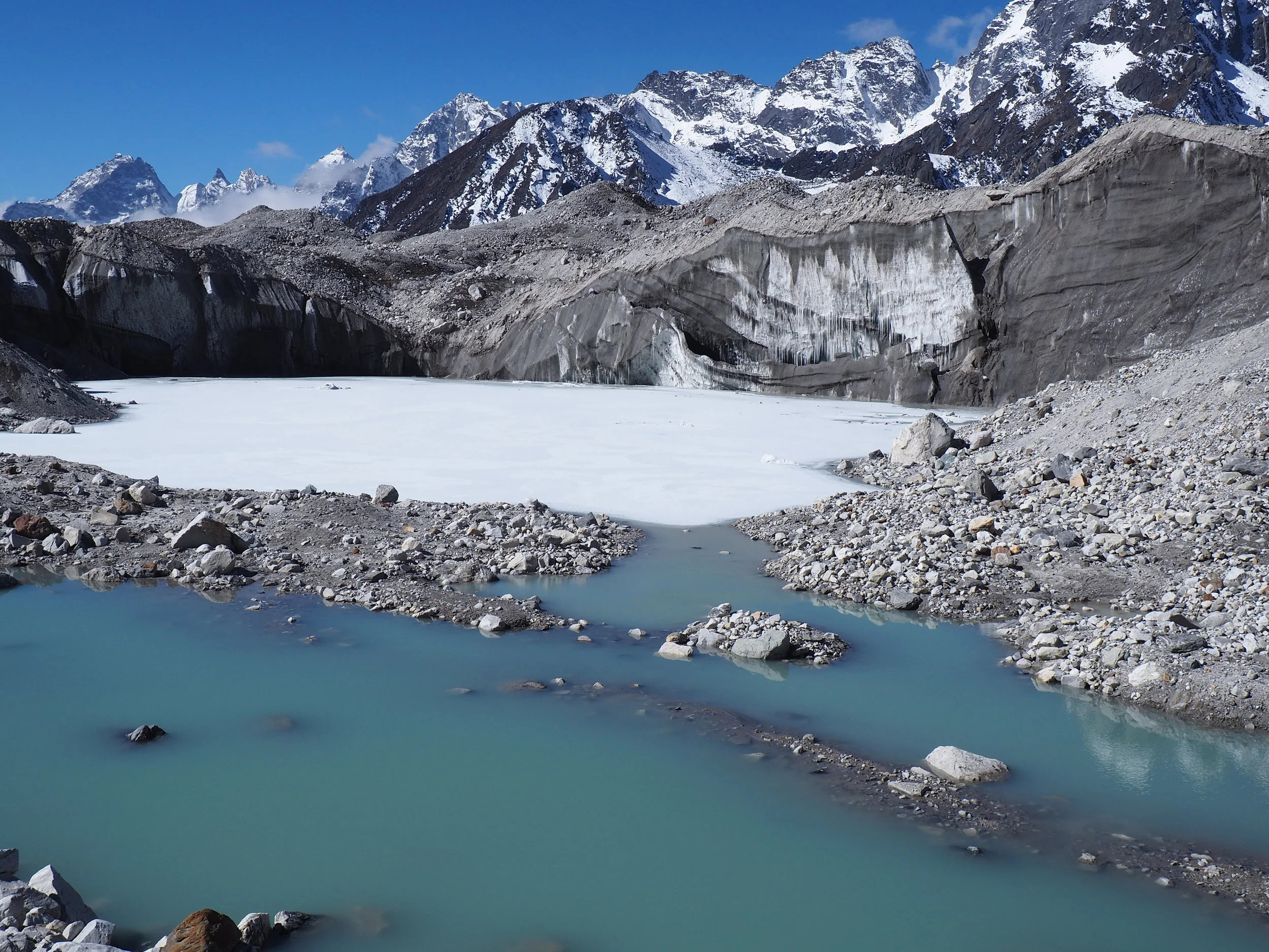
We dropped down on top of the glacier, navigating small pebbles and huge boulders along a path which led up and over piles of rocks. We walked directly alongside a frozen pool of deep white, complemented by a sheer vertical wall of dirty ice and stalactites.
While we stood there admiring the view, the sun began hitting the ice and a few chunks began to rip off. It was a topical reminder that even though the mountains and glaciers all around us seemed frozen in time, the geology of the landscape is actually constantly in flux.
Now we had to begin crossing the width of the ice field; grey hills surrounded us with impressive heights, each one hiding a multitude of ice underneath. We kept one eye on the ground in front of us and the other taking in the vast beauty of the landscape. A multitude of snowy mountains were present every way I turned, acting like battlements that kept us safely enclosed in a castle of nature’s most gorgeous offerings.

I couldn’t help but just spin in circles from the best vantage points, soaking in the warm sun, crisp air and bountiful glacial views. From the latter half of the crossing, we were granted an angle which enabled us to peer directly back towards the source point of the ice flow, which stretched much further than either of us could fathom.
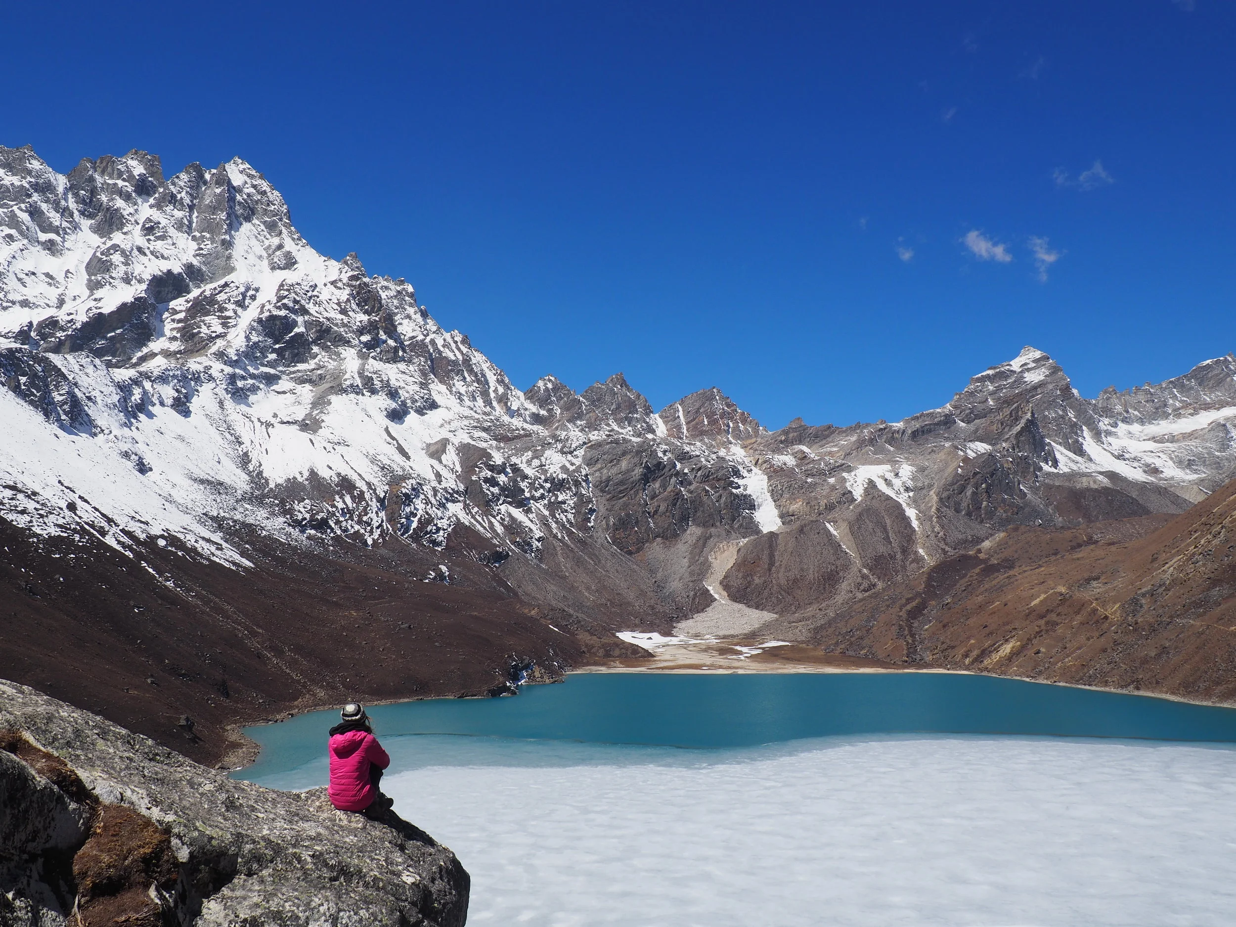
We paused for plenty of pictures and long stares at the glacier from every conceivable angle, then worked our way up the far slope at a torrid pace. Just 15 minutes later we were peering out from a hilltop vantage point over the town of Gokyo and its corresponding lake, grateful to have perfect weather that enabled us to fully appreciate the heavenly location that would serve as our base for the next 3 days.